On May 25, 2020, invited by Surveying and Mapping Engineering Institute, Dr. Yuechen Li from Southwest University, Dr. Yugang Tian from China University of Geosciences (Wuhan), and Mr. Jun Zhou, Professorate Senior Engineer of Chongqing Survey Institute brought three wonderful online academic reports for the teachers and students of our college and other universities. The reports were held via the Tencent Meeting App. The topics of these three reports were: “Ecological Security Space-time Pattern in Chongqing Based on Grid Cells”, “Novel Spectral Indices to Map Urban Impervious Surface Area: Development and Validation”, and “Application of 3D Laser Scanning in Engineering Survey”. Associate Professor Ronghua Yang presided over this report.
First, starting with the issues of agricultural non-point source pollution, soil erosion, engineering water shortage, and geological disasters that the ecological security in Chongqing faces, Dr. Yuechen Li introduced the establishment of ecological safety evaluation index system in Chongqing and the comprehensive evaluation method of the ecological safety in Chongqing. He analyzed the spatial correlation degree, ecological security differentiation characteristics and ecological security driving mechanism of the ecological security in Chongqing. And the following conclusions were drawn: the trend effect of the ecological security in Chongqing is obvious, there is a strong spatial autocorrelation, ecological safety are mainly distributed in woodland and grassland, and the ecological environment quality is positively correlated with elevation and slope, etc. These conclusions provide extremely important ideas and basis for the ecological safety management decision-making of Chongqing.

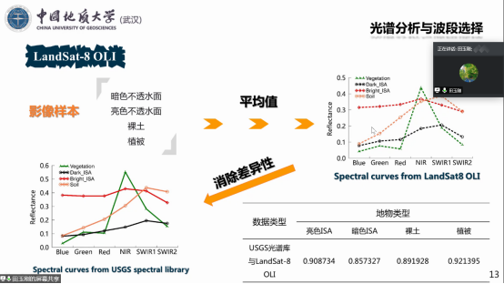
Then, starting with the phenomenon that a large amount of natural land was replaced by the urban impervious surface during the urbanization process in his hometown, Dr. Yugang Tian introduced the significance of the impervious surface extraction and the idea of studying the spectral index of the impervious surface. He gave the construction method of the ratio type impervious surface index, the construction method of the city normalized impervious surface index based on the virtual band. Next, a new index performance evaluation system is proposed, and the index performance is evaluated from three aspects: extraction accuracy, correlation analysis and separation analysis, and good results were obtained.
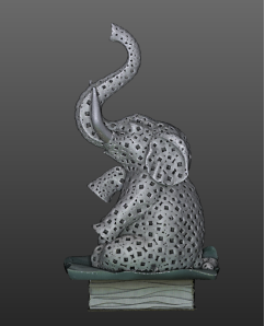
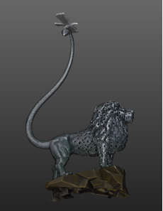
Finally, starting with the principles of Mobile Laser Scanning and Terrestrial Laser Scanning, Mr. Zhou Jun, the Professorate Senior Engineer, introduced the application of some engineering projects. These projects included Chongqing-Guangzhou Interchange Highway Survey, i-VISTA Automated Driving Challenge Field Measurement, Huangge Bay Interchange Completion Survey, Chongqing Metro Line 3 measurement, Guoyuan Port 3D measurement, greening surface area measurement, Yangtze River channel riparian zone measurement, tunnel measurement, building completion measurement, hand-held mobile measurement in the garage, surveying and mapping of architectural relics, statue measurement, irregular plastic stone measurement, bridge completion measurement. In the end, he summarized the problems that need to be solved urgently in vehicle application and ground scanning in engineering applications.