June 8, 2020, at the invitation of the Institute of Surveying and Mapping Engineering Institute, Dr. Yingchao Zhao from Chang'an University, Mr. Tiejun Wang, Senior Engineer of Chongqing Institute of Surveying and Mapping, Dr. Feifei Tang from Chongqing Jiaotong University, and Dr. Tao Wang from Chongqing University brought four wonderful online academic reports for teachers and students of our school and other universities. The reports were held via the Tencent Meeting App. The topics of these reports were: “InSAR technology used in investigation and monitoring of geological hazards at different scales” “Practical application of new technology in aerial photogrammetry” “Research and Practice of UAV Low Altitude Remote Sensing Technology” “Research progress of displacement tag radar measurement system”. Associate Professor Yali Zhang presided over this report.
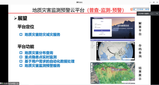
First, starting with the background of geological hazard research, Dr. Chaoying Zhao introduced the INSAR landslide identification, monitoring, and early warning system. He shared the InSAR surveying and monitoring technology of the Loess Plateau geological disaster represented by the Heifangtai Dangchuan landslide group and its successful early warning experience, InSAR surveying and three-dimensional monitoring technology in the alpine gorge region represented by the Jinshajiang basin landslide and the Baige landslide in Tibet, investigation and monitoring technology of karst landslide insar represented by typical landslide in Guizhou, Sichuan, Sichuan. At last, Dr. Chaoying Zhao summarized the advantages and limitations of insar technology for geological disaster monitoring, showed the geological disaster monitoring and early warning cloud platform developed by his team and gave detailed answers to the questions raised by online teachers and students.
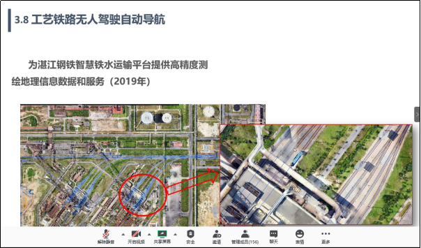
Then, Director Tiejun Wang briefly reviewed the development of aerial photogrammetry. He focused on the national and local major surveying and mapping projects undertaken by Chongqing Institute of Surveying and Mapping, MNR, and explained many new technologies of aerial photogrammetry in recent years and their application in production practice. At the same time, Director Tiejun Wang introduced Light Detection and Ranging (Lidar), Synthetic Aperture Radar (SAR), Remote Sensing (RS) and other related high-tech technologies, as well as their application in production projects, and introduced the development prospects of photogrammetry in general. At last, he gave detailed replies to the questions raised by online attendants.
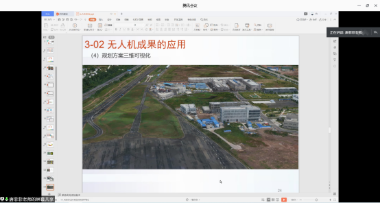
Next, starting from the composition of the UAV system, Dr. Feifei Tang introduced the key elements of selecting the UAV system for application requirements, the method of judging data quality, the factors affecting the data quality, and the types of UAV data achievements. She shared the application of UAV in the production of aerial survey topographic maps, change detection based on orthophotos, three-dimensional models of real scenes, three-dimensional visualization of planning schemes, etc. At last, she gave detailed replies to the questions raised by online attendants.
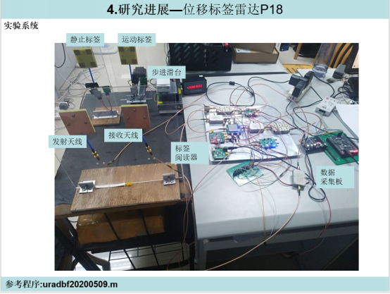
Finally, starting from the importance of micro-displacement and micro-deformation to the safety of civil engineering construction, Dr. Tao Wang introduced the engineering and scientific significance of micro-displacement and micro-deformation measurement, micro-displacement optical measurement method and microwave method, principle and typical products of ground-based real aperture radar and problems in the measurement method of micro-displacement of foundation. He gave solutions to the corresponding problem presented above and showed the latest research results of his team, including point-frequency radar and displacement tag radar. At last, he briefly described their future research plan.