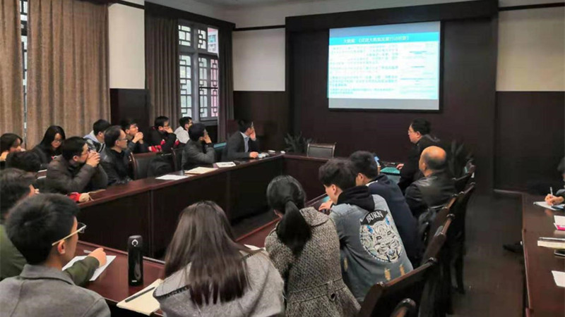
Professor Qin Kun, the vice-president at School of Remote Sensing and Information Engineering, Wuhan University, was invited to School of Civil Engineering in Chongqing University and presented a special lecture entitled “Big Data Analysis and Mining for Remote Sensing”. This is the third lecture of interdisciplinary integration of Geomatic Engineering in our school.
At first, associate chair of SCE Zhang Wengang introduced Prof.Qin Kun to all the teachers and students, and expressed warmly welcome and heartfelt gratitude for his arrival. Later, Prof.Qin Kun delivered a detailed introduction about the history and development of School of Remote Sensing and Information Engineering of Wuhan University. The introduction shows the achievement of new engineering curriculum based on interdisciplinary integration in Wuhan University, including the establishment of the Aerospace Science and Technology institution (Interdisciplinary with Aerospace Engineering), joint cultivation of talents with Chinese Academy of Sciences (Collaboration R&D of Remote Sensing Instruments), multi-disciplinary integration with Humanities and Social Sciences (Social Geographic Computing and Spatial Sociology of Humanities), set up the fully English based three-semester curriculum, undergraduate students cultivation program for Remote Sensing Science and Technology. Afterwards, Prof. Qin Kun gave a talk about Big Data Analysis and Mining for Remote Sensing and introduced its applications. The topic includes: Overview of big data analysis; Four paradigms of scientific research; the development of data-intensive technology; Review of spatio-temporal big data analysis in remote sensing; Luojia No.1 satellite(free download) from Wuhan University; Night-time light remote sensing data analysis in Syria; Urban big data computing; Ideas for establishment of spatio-temporal big data; Anomaly target detection for no-man’s land using deep learning methods; Variation detection of construction based on multi-scale filtering; Behavior and trajectory analysis on taxi data in Wuhan; Behavior and trajectory analysis on GPS watch data provided by volunteers; Hotspot extraction and interactive network analysis; Network congestion and interaction analysis; Anomaly trajectory detection and analysis; Fire detection based on temporal remote sensing images; Annual risk assessment of natural disaster(earthquake, flood, drought, typhoon); Lake water quality monitoring system. Meanwhile, associate chair Zhang Wengang, associate chair Xie Qiang, Prof.Wen Haijia, Profs.Liu Wengu, Profs.Zhang Yali, Prof. Zhang Weifu, Prof.You Yangsheng, Prof.Yang Ronghua, undergraduate and graduate students had a deep discussion with Prof.Qin Kun. Finally, associate chair Xie Qiang and associate chairt Zhang Wengang gave a summary and expressed their gratitude again for Prof. Qin Kun’s visit and his interesting speech.
The academic lecture not only gave the audiences a deeper introduction on the Remote Sensing Big Data development, but also made them have a better understanding about Remote Sensing and its engineering applications. The talk opened audiences’ mind, broadened their eyesight, and gave them a deeper understanding of Geomatics Engineering and its multi-disciplinary integration.